
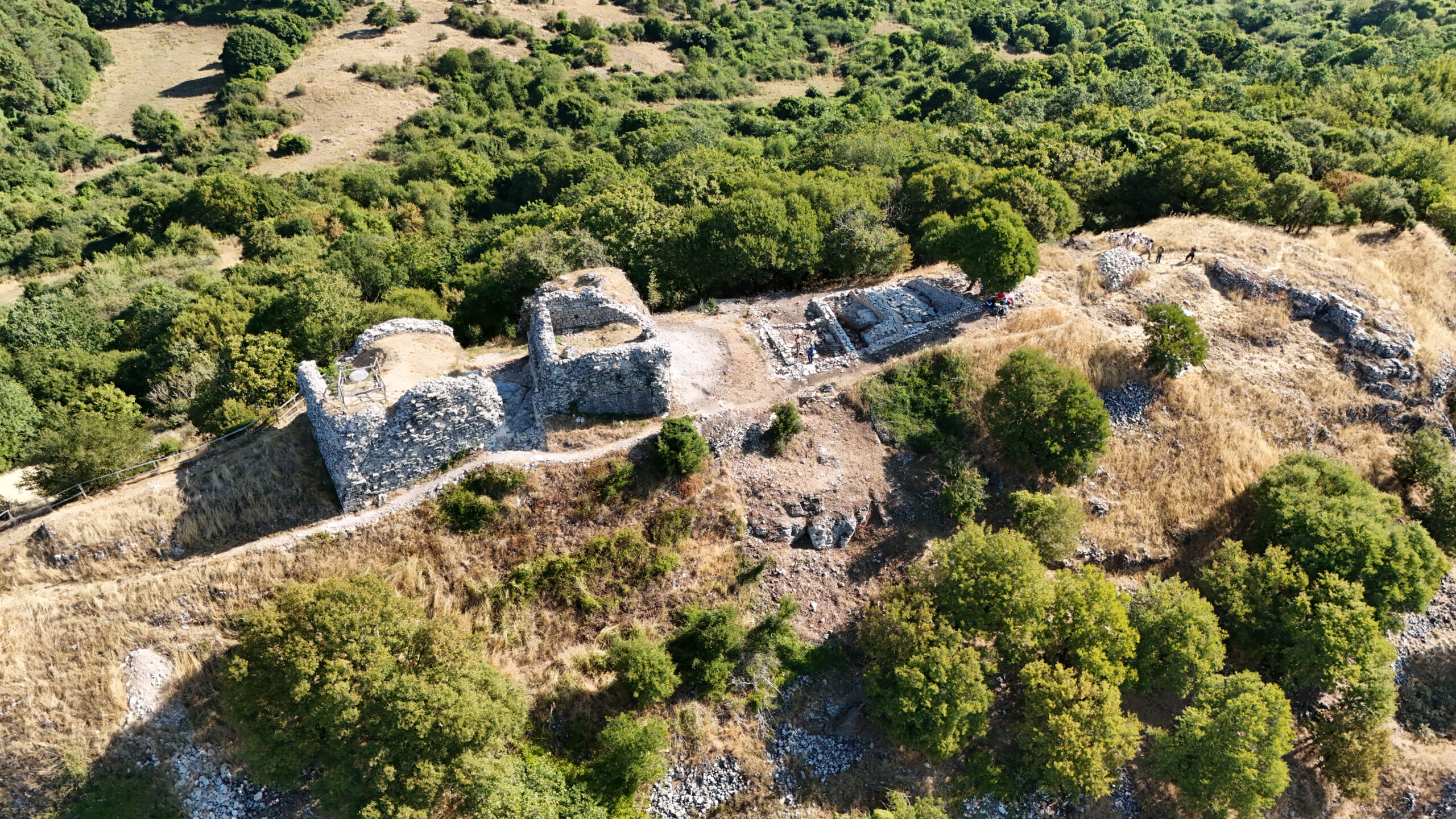
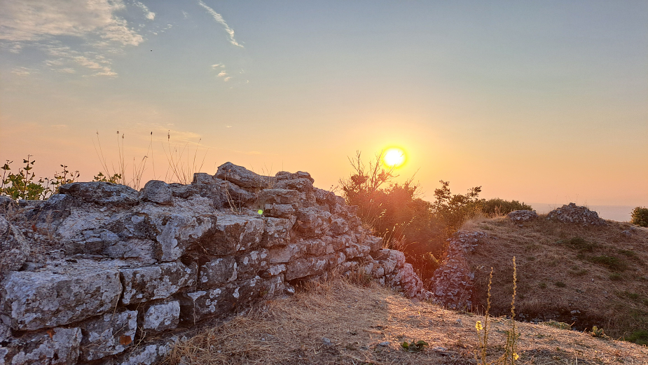
On an unnamed hilltop overlooking the valleys and surrounding landscape as far as the eye can see, within the Montevitozzo common lands, the ruins of the Roccaccia have been a familiar landmark for generations: a destination for walks, local stories, and shared memories, but never the subject of systematic archaeological investigation.
That changed in 2025. Plans for major, far-reaching construction associated with an industrial wind-energy project in the immediate vicinity of the Rocca prompted a strong response from the Montevitozzo community and the local common-land administration. That mobilization gave rise to a research project: to turn a heritage-protection challenge into an opportunity to understand, at last, what the Roccaccia actually was and what role it had played in the history of this landscape. Under Ministerial Research Permit No. 868, issued on June 5, 2025, ACT began the first systematic campaigns of archaeological survey, documentation, and excavation at the site.
From the very first campaigns, the Rocca proved far more complex than we had imagined.
A Contested Stronghold
Its historical name, Rocca Tédula, first appears in 1188, in a papal bull issued by Pope Clement III to the canons of Sovana. The document refers to the Rocca together with its church, appurtenances, and revenues, showing that by the late twelfth century this was not simply an isolated tower, but the center of an already organized territory.
In 1216, Montevitozzo appears in the division of the Aldobrandeschi domains as the center of a curia et districtus encompassing several settlements in the surrounding area. Over the following centuries, the Rocca repeatedly changed hands and became caught up in the competition among the Aldobrandeschi and later the Orsini, Orvieto, Siena, the lords of Montorio, and other powers of southern Tuscany. In 1305, it was besieged and captured by Orvieto; further conflicts followed during the fourteenth century, and in 1380 it entered the Sienese sphere of influence. The documentary record thus reveals a history that was anything but marginal, closely connected with control over a corridor linking Mount Amiata, the Maremma, northern Lazio, and the territory of Orvieto.
Between the late fifteenth and early sixteenth centuries, the military role of the old Rocca—by then incorporated into the Orsini domains of Pitigliano—appears to have gradually declined. In the seventeenth century, the territory came under Medici control and subsequently passed to the Barbolani di Montauto, who received Montevitozzo as a marquisate.
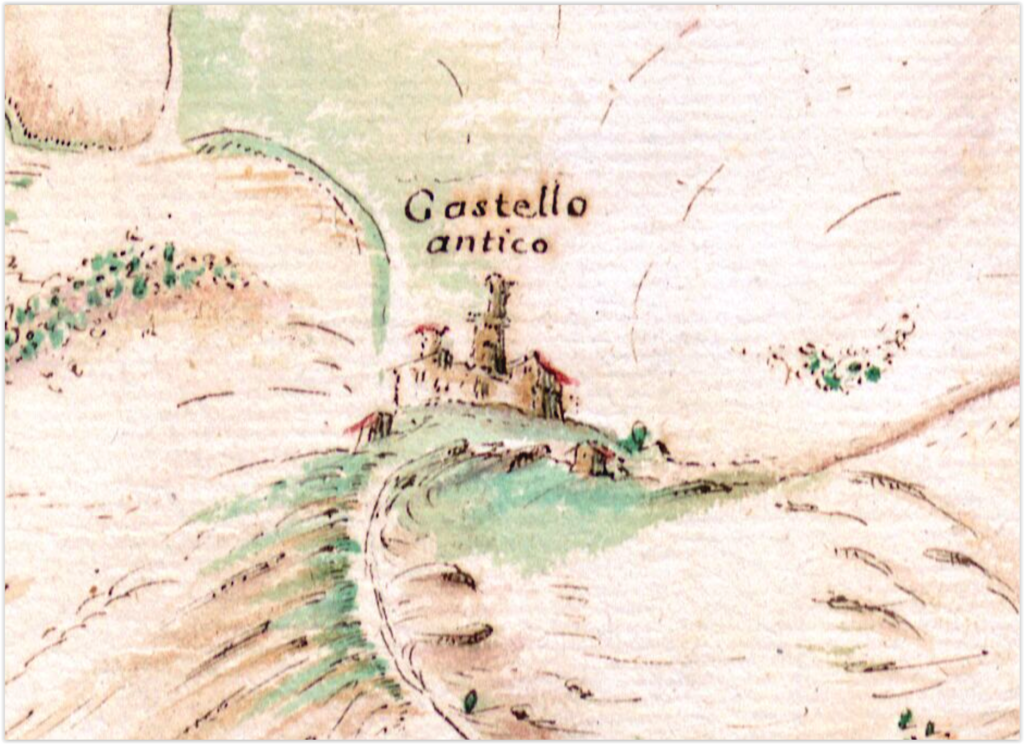
The Rocca, however, did not immediately disappear from the landscape. Eighteenth-century maps still identify it as an “Ancient Castle,” depicting a prominent tower surrounded by other buildings. It is a particularly intriguing image in light of what archaeological excavation is now bringing back to light.
Not Just a Tower, but a Complex Fortified Settlement
Before our investigations, the Roccaccia was generally understood primarily as a fortification: a tower, a few stretches of masonry, and the remains of an enclosure wall, strategically located, but essentially marginal.
Archaeological survey, topographic mapping, drone photogrammetry, laser scanning, DTM analysis, architectural archaeology, and stratigraphic excavation have revealed a very different picture.
The fortifications enclosed an area of approximately half a hectare, but structures belonging to the settlement also extended beyond the walls. At the summit stood the main fortified core, a kind of keep far more complex than it first appeared: a quadrangular Tower with no ground-level entrance, a large building that we have conventionally named the Palazzo, a courtyard, and additional structures whose functions and extent have yet to be fully determined. The walls of the Palazzo, built of carefully squared and finished stone blocks, reflect a level of construction consistent with both residential and representational functions.
Around this core, however, there was something even more significant: a village.
On the southern slope, we have identified numerous structures, some of which appear to have been partially cut directly into the limestone hillside. Roads and passageways made use of rock-cut channels and terraces, while the defensive wall followed the natural morphology of the escarpment, reinforcing the most accessible sectors and relying on the natural defenses of the slope where the terrain itself was sufficient to protect the settlement.
The Rocca Tédula now emerging from the archaeological record was therefore not simply a place from which a handful of soldiers watched over the surrounding territory. It was a small but complex settlement, combining military, administrative, residential, domestic, and productive functions.
Living and Working at the Rocca
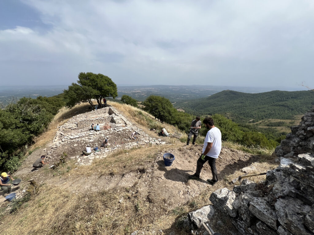
The excavation of Building 1, located outside the main fortified core, has played a decisive role in shaping our interpretation of the site.
This substantial utilitarian building, more than twenty meters long and divided into several rooms, served a range of functions related to storage, food processing, and craft production. Basins, channels cut into the bedrock, postholes, hearths, carbonized grain, animal remains, and tools are gradually revealing small fragments of the everyday lives of the Rocca’s inhabitants.
Evidence for textile production is particularly significant. Several fragments of archaic maiolica pottery were carefully cut down and perforated to be reused as spindle whorls: extremely simple objects, but, together with other comparable finds, sufficient to demonstrate that spinning took place at the Rocca. Subsequent campaigns have produced further evidence that is beginning to allow us to investigate wool working and the role such activities may have played in the settlement’s economy.
Pottery, too, is more than simply a tool for dating archaeological layers. The quantities, forms, provenance, and technological characteristics of the ceramic assemblage provide evidence for patterns of consumption and commercial connections, while also raising new questions about the possible presence of manufacturing activities associated with ceramic production.
Weapons and projectiles are present: arrowheads, crossbow bolt heads, and a pike head inevitably recall the Rocca’s military function, but they do not dominate the archaeological record. What emerges above all is the life of a community.
The Questions That Remain
Every field season, naturally, answers some questions while opening many others.
How was the village organized? How many people could have lived at the Rocca, and what was the relationship between their houses, the productive buildings, and the seigneurial core?
And above all: where was the church already mentioned in 1188? Several structures identified in the Bellino Valley may belong to an apsidal building, but at present we cannot determine whether they are in fact the remains of the Rocca’s medieval church.
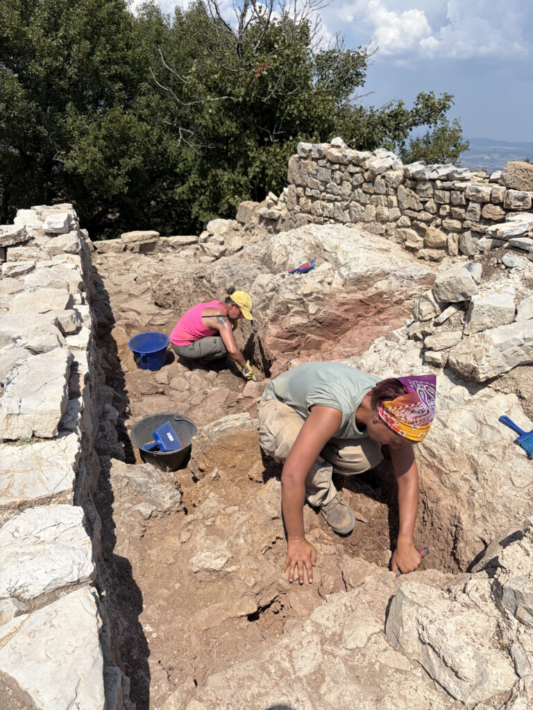
Another question may take us even further back in time. Beneath several medieval structures, we have identified cuts, channels, and drainage systems carved directly into the limestone bedrock. In Building 1, one of these channels clearly predates the walls built over it.
But by how much?
Does it belong to an earlier phase in the organization of the medieval Rocca, or does it preserve evidence of even older activity on the hilltop? For now, we do not know. And that is precisely one of the questions that future campaigns will seek to answer.
The Future of Rocca Tédula
Excavations will continue over the coming years. The historical and archaeological significance of the complex is now clear, but we still know only a portion of the settlement.
Future research will aim to establish the chronology of its different construction phases, understand the organization of the village and its productive areas, investigate the fortified core in greater depth, and locate the church. But from the outset, the project has had another goal as well.
The Rocca must once again become a place belonging to the community.
For this reason, research, preservation, and public engagement are proceeding together. Site visits, fieldwork updates, and the participation of local residents are not peripheral activities associated with the excavation: they are an integral part of the project itself.
The long-term goal is to make Rocca Tédula the archaeological center of the future Montevitozzo Common Lands Park: a place where research can continue, but also a point from which to tell the story of the landscape, history, and communities of this part of the Maremma del Tufo.
Because what for centuries was simply “the Roccaccia” is revealing itself to be something very different: not the ruins of a forgotten tower, but the remains of one of the key centers in the organization of the medieval landscape.
Leave a Reply