
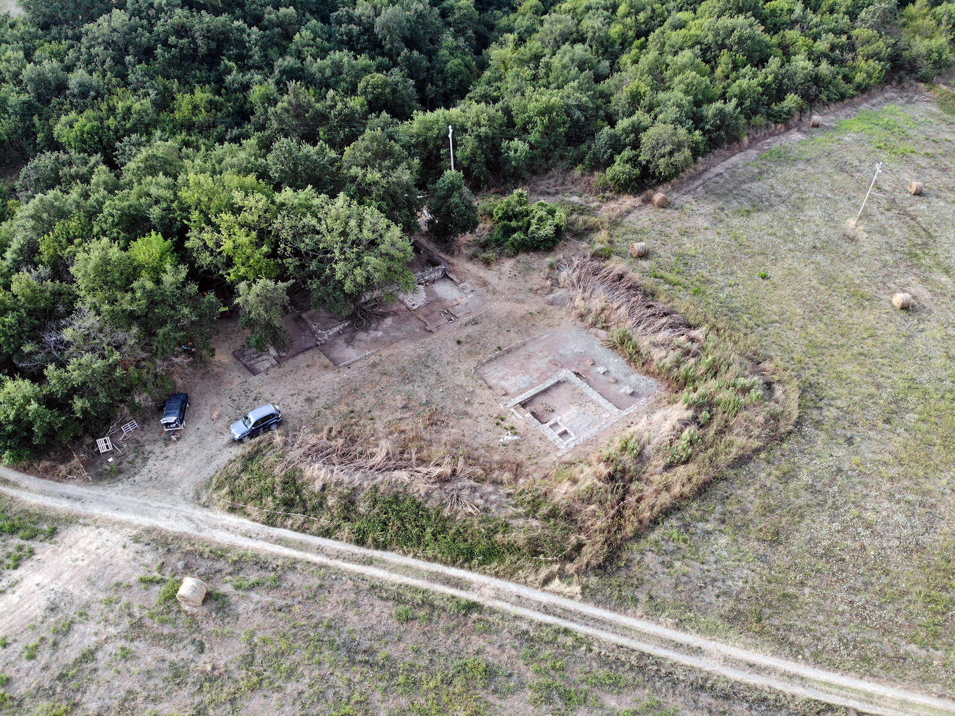
From an archaeological survey to a long-term research project: the La Biagiola site tells more than two thousand years of the history of the Sovana area and, at the same time, reflects an approach to archaeology built around research, preservation, training, and collaboration.
La Biagiola is located on the Pianetti di Sovana, just north of the ancient city, in a landscape where archaeological remains have coexisted for centuries with farmland, woodland, and rural settlements. When volunteers from the Gruppo Archeologico Torinese identified a substantial concentration of archaeological material and several masonry structures in the area in 2004, it was not yet possible to anticipate the complexity of the site concealed beneath land that had long been cultivated.
The surveys had begun as part of a project promoted by the Superintendency, primarily aimed at documenting and protecting the archaeological heritage scattered across the territories of Sorano, Pitigliano, and Manciano. This work led to the identification, near Cascina Merlini, of surface concentrations of pottery and building materials, predominantly dating to the Roman period, as well as the remains of masonry structures in the woodland along the edge of the field, some of them built in opus quasi reticulatum.
The area, however, was not entirely unknown. Nineteenth-century accounts by the Società Colombaria recorded discoveries on the Pianetti di Sovana, although their identification with La Biagiola remains only a hypothesis. As late as 2004, a rather confused memory of ancient discoveries in the area also survived among the local population. Tombs, buildings, weapons, and other finds had gradually become part of an oral tradition in which reliable information could no longer easily be distinguished from later reinterpretations.
Archaeological research therefore had to do what is often necessary in landscape projects: begin with the available information, including the most uncertain evidence, test it in the field, and gradually distinguish the data from their interpretations.
From a Roman Villa to a Multiperiod Site
The first stratigraphic investigations, carried out between 2009 and 2011, soon demonstrated that the definition of the site as a “Roman villa,” while correct, described only part of its history.
Alongside the Roman structures, an early medieval burial area emerged, with graves frequently affected and damaged by agricultural activity and, probably, looting. Radiocarbon dating of three burials produced calibrated ranges of AD 700–980 and AD 650–890. These results are consistent with the chronology of Lombard-period artifacts found at the site, including those recovered from two burials identified in 2011 in the area known as Trench B.
When the Associazione Cultura e Territorio began coordinating the work of professional archaeologists in 2012, the research questions were therefore already much broader: the challenge was to understand a site in which structures and phases of occupation belonging to different periods overlapped and, in many cases, had altered or erased traces of earlier phases.
Over the following years, excavation gradually outlined a sequence that, despite the many questions that remain open, documents activity in the area from the Etruscan period through the modern era, with a hiatus between the Early Middle Ages and the later reoccupation of the site.
The earliest evidence appears to date to at least the fifth century BC and consists primarily of artifacts recovered during excavation and periodic surveys of the surrounding area. Some alignments of squared tuff blocks underlying later structures may belong to this phase, as may some of the features cut into the bedrock. Their interpretation remains difficult, however, because later transformations profoundly affected the original stratigraphy.
A Roman Villa That Changed Over Time
The Roman villa itself was not a static complex.
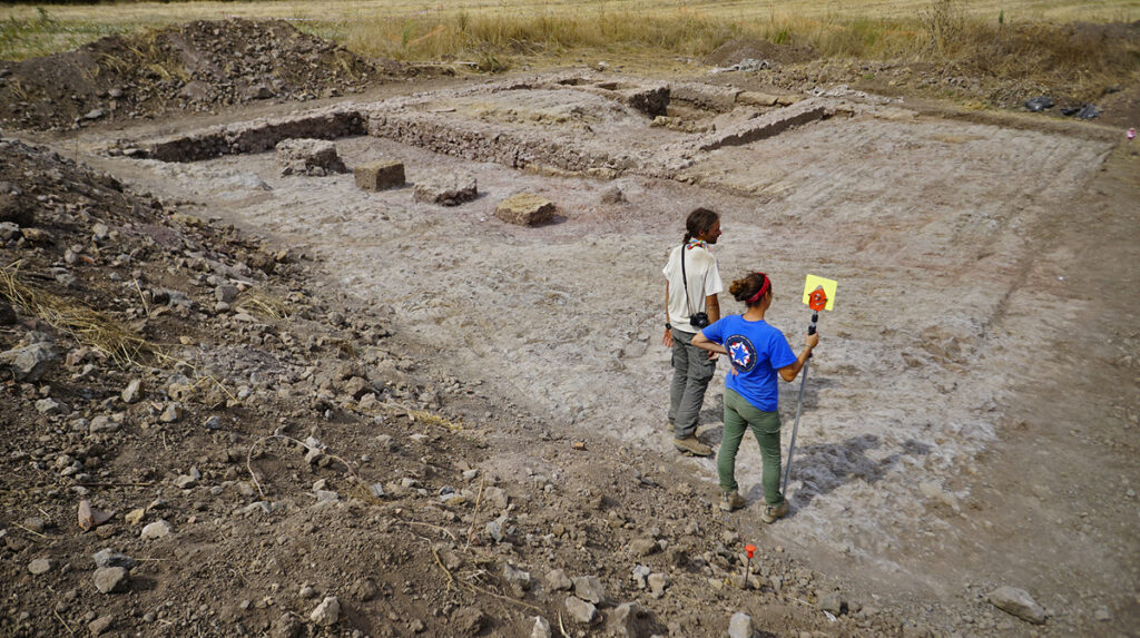
Research has identified several constructional and functional phases and has made it possible to distinguish an area devoted to productive activities from another with a more residential character.
At least two large spaces have been identified within the pars rustica. The first, already investigated by the Gruppo Archeologico Torinese, contained a cistern and a silo. In the second, archaeologists identified basins probably used for settling liquids and at least four dolia, represented either by surviving fragments or by traces preserved in the bedrock. Together, these features suggest that this part of the complex was associated with the processing and storage of agricultural products, probably wine or oil.
The productive rooms also opened onto a large area without buildings, bordered along one side by a short portico. Some of its supports were doubled, probably for structural reasons.
The relationship between this sector and the pars urbana is more difficult to reconstruct. Excavations conducted between 2012 and 2017 in the area west of the Casalaccio identified an irregularly preserved cocciopesto floor and several truncated walls that still retained traces of opus reticulatum. These remains may belong to a transitional area connecting the productive and residential parts of the complex.
The pars urbana, by contrast, appears to extend at least partly beneath the structures of the Casalaccio, whose construction severely affected its preservation. To the north, an area was identified with a waterproof cocciopesto floor, tuff curbs on which the walls probably rested, a large circular corner column, and two channels, one for water supply and the other for drainage; the latter was subsequently blocked. These characteristics have led to the interpretation of the room as part of a bathing complex, although later modifications make its original layout difficult to reconstruct.
This continuous transformation is precisely what makes La Biagiola particularly interesting. Excavation does not provide a snapshot of a single moment, but rather a succession of different ways in which the same place was built, used, and modified.
Some portions of stratigraphy that survived later transformations appear to indicate a process of abandonment and decommissioning of the villa around the fifth century AD. Ongoing studies, however, suggest the possibility of sporadic later occupation, at least in the area of the pars urbana.
The Early Medieval Cemetery
At some point after the abandonment of the Roman structures, part of the site was used as a burial ground.
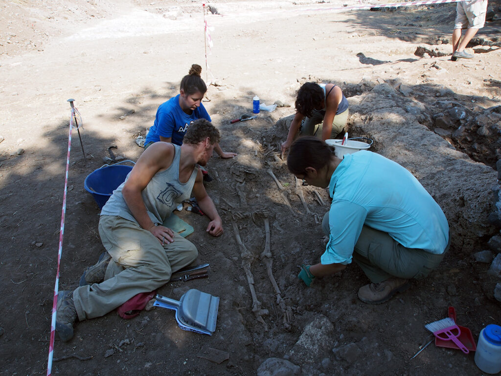
The burials are numerous and occupy a fairly extensive area. They are more dispersed in the woodland, while reaching a higher concentration within a strip approximately five meters wide along the western side of the Casalaccio. The graves frequently overlap both one another and earlier structures and were themselves affected by later transformations.
With the exception of the two burials identified by the Gruppo Archeologico Torinese, no true grave goods have been recovered. One burial contained a bone die, but it is impossible to determine whether it was intentionally deposited with the deceased or whether its presence was accidental.
Overall, the cemetery is characterized by irregularly arranged burials, without a consistent orientation, belonging to individuals of different ages and sexes. Anthropological analyses have also identified evidence of physical stress that can be associated with daily labor.
The distribution of the graves appears to show some internal differences. In the southwestern corner of the Casalaccio, for example, a concentration of burials of women and children has been observed. This area, however, has not yet been investigated extensively enough to assign a definite meaning to this distribution.
This too is an important aspect of archaeological work: recognizing what the evidence allows us to say while leaving open those questions that excavation has not yet answered.
After the Cemetery: The Return of Rural Activities
The history of La Biagiola did not end with the Early Middle Ages.
Numerous late medieval artifacts have been recovered from the upper layers, although these deposits have been heavily disturbed. Their presence, together with structures built over some of the better-preserved Roman walls, indicates renewed rural use of the area between the Middle Ages and the modern period.
A building probably extending over at least two stories appears to belong to this phase. On the ground floor were two service rooms equipped with masonry benches and what may have been the base of a hand-operated press. The upper story was probably residential, as suggested by material from the floor structure found during the initial clearing of the ruins.
Once again, however, modern alterations have destroyed much of the stratigraphy that might otherwise have allowed the different phases of use of the building to be reconstructed in greater detail.
A Project Built Over Time
Since 2012, La Biagiola has gradually also become a laboratory in which research, preservation, and training could develop together.
During the first two years, ACT’s work was supported by the nearby La Biagiola winery, which was beginning its activities at the time and chose to invest in the study and enhancement of the local cultural heritage. In subsequent years, archaeological research was supported through additional private contributions.
Beginning in 2014, the project also opened to students from several international universities, giving them the opportunity to work with the complexity of a multiperiod archaeological site. Since 2016, the Association has directly managed research activities under an archaeological research concession, while maintaining close coordination with the Superintendency.
A continuous presence at the site also made it possible to address preservation alongside research. Once archaeological structures are exposed, they must be monitored, maintained, and, when necessary, stabilized. Since 2016, in agreement with the Superintendency, the excavation areas have no longer been reburied at the end of each field season. Their preservation is governed by a protocol that provides for regular inspections, maintenance of the structures, and continuous monitoring of the site.
It was within this context that the La Biagiola International School of Archaeology also developed. A site of this complexity offers students something very different from an ideal stratigraphic sequence: it requires them to work with truncated structures, disturbed stratigraphy, reuse, overlapping phases, preservation issues, and interpretations that must constantly be tested against the archaeological evidence.
In other words, with archaeology as it is actually practiced.

From the Pandemic to the Resumption of Research
COVID-19 and the events of 2020–2022 brought archaeological investigations to a halt and provided the Association with an opportunity to reconsider the future of the project. From 2023 onward, ACT increasingly directed its research toward other projects, while continuing, in coordination with the responsible Superintendency, to implement the monitoring and preservation protocol for the site.
In 2026, discussions and planning began for the resumption of research at La Biagiola, also taking into account the new methodologies and documentation and investigation techniques progressively incorporated into our work.
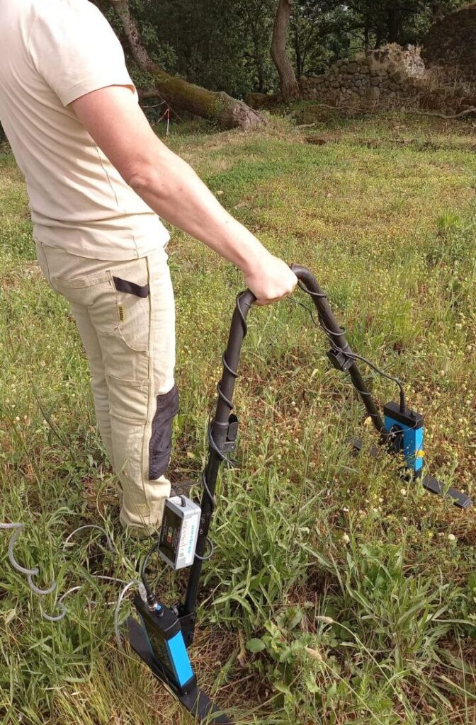
As part of the research concession for non-invasive investigations in the municipalities of Sorano and Pitigliano, a new campaign of archaeological prospection and geophysical survey using ground-penetrating radar (GPR) has now begun. Its purpose is to define more precisely the extent and organization of the archaeological remains and to help guide future stratigraphic investigations.
La Biagiola Today
More than twenty years after its identification, La Biagiola remains an open research project.
The broad outlines of its history can now be recognized: a pre-Roman phase that remains difficult to define; the construction and transformation of a Roman villa divided into areas with different functions; the gradual abandonment and reuse of its structures; the establishment of an early medieval cemetery; and, finally, the return of rural activities between the Middle Ages and the modern period.
Many questions, however, remain open. Investigations carried out in 2018 and 2019 in the wooded areas east and north of the Casalaccio further expanded this picture, demonstrating the continuation of the cemetery and identifying additional structures and phases of occupation. Architectural terracottas recovered from the preparation layers of some Roman structures may also suggest the existence of a phase with a possible cultic function between the third and first centuries BC. At the present stage of research, however, this remains a hypothesis requiring further investigation.
This is why La Biagiola continues to be important to ACT. It is not only one of the Association’s longest-running research projects; its history has also helped shape an approach that we now apply elsewhere: long-term research, close attention to the landscape, integration of different sources of evidence, collaboration with heritage authorities, field training, and an awareness that an archaeological project does not end when a field season is over.
Understanding an archaeological site also means preserving it, continuing to ask questions of it, and, over time, returning to the wider community what archaeological research allows us to understand.
Leave a Reply